Developing a spatially-explicit land cover change model that represents the dynamic interaction between development and biophysical processes
Investigators: Alberti, M.,Hepinstall, J.
Funding: National Science Foundation
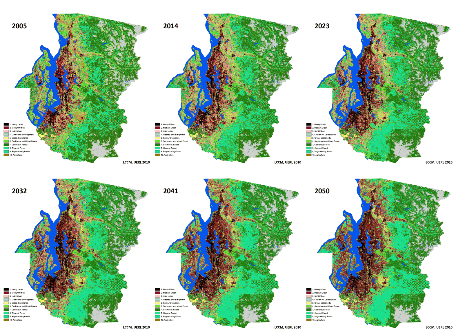
Description: One of the most influential factors in human-induced global change over the last two hundred years has been the transformation of land and resource use associated with urbanization and sprawling development (Pataki et al. 2006). Land cover change is expected to increase significantly in the coming decades as populations continue to expand. As part of this project, Dr. Alberti (University of Washington) and Jeff Hepinstall (University of Georgia) have developed a coupled human-natural land-cover change model to assess the impact of alternative development patterns in the Central Puget Sound Region that can support land use and infrastructure investment decisions. The model has successfully been applied to assess the impact of land cover change on bird diversity (Hepinstall et al 2008). As part of this project, the model is currently being extended to 2050 and further partitioned to fully represent the complex and heterogeneous land use/land cover patterns and behaviors emerging along the urbanization gradient.
 In the Biocomplexity project, the land cover change model is the link in our system between human development events and land use changes and the biophysical model, providing bi-directional feedback and interactions between socioeconomic and biophysical processes. Consisting of a set of spatially explicit multinomial logit models of site-based land cover transitions, the model is structured to predict the probability of a single cell changing from one discrete land cover class to another class as a function of: (1) the present land cover class of that cell, (2) a set of attributes of the cell, and (3)the specific development event predicted by the development model within the cell. Transition probability equations are estimated empirically as a function of a set of independent variables comparing land cover data interpreted from Landsat Thematic Mapper (TM) imagery for the Puget Sound region taken every two years between 1986 and 2001. We use Monte Carlo simulation to determine whether each pixel of a specified land cover class changes to another cover type or remains in its current state.Land cover change is driven by both biophysical and human agents, each operating through different mechanisms. Biophysical processes, such as vegetation dynamics, involve alterations in cover due to natural changes in climate and soils, as well as succession following disturbances. Land uses affect land cover both directly, through replacing the land surface, and indirectly, by modifying the availability of nutrients and water. Land conversion affects the functioning of natural systems by modifying biophysical processes at local, regional, and global scales. Changes in land cover and their ecological impacts, in turn, affect land use decisions through the demand for and profitability of land development. Thus models of land cover changes need to explicitly represent both human and biophysical processes.
Independent variables include those that measure biophysical factors (e.g., landscape composition and configuration) and those that measure human factors (e.g., land development). We use a set of landscape metrics derived from information theory to model the effect of the complex spatial pattern of land use and land cover on human and ecological processes. These metrics characterize the composition (e.g. diversity, dominance etc.), spatial configuration (e.g. density, size, shape, edge, connectivity, fractal dimension) and spatial neighborhood (e.g. heterogeneity and contagion) of the landscape. We also improve the realism of the land cover change component by specifying land cover attributes of parcels and their neighborhoods in the development component of UrbanSim, as well as adding spatial configuration and neighborhood effects of both land use parcels and land cover patches. Spatial metrics are used to model the effects of land use and cover patterns on ecosystem change.
Read more:
Related themes: Resilience and complexity, modeling land cover
Publications: Hepinstall, J. A., Alberti, M., Marzluff, J. (2008), Predicting land cover change and avian community reponses in rapidly urbanizing environments, Landscape and Urban Planning, DOI 10.1007/s10980-008-9296-6.